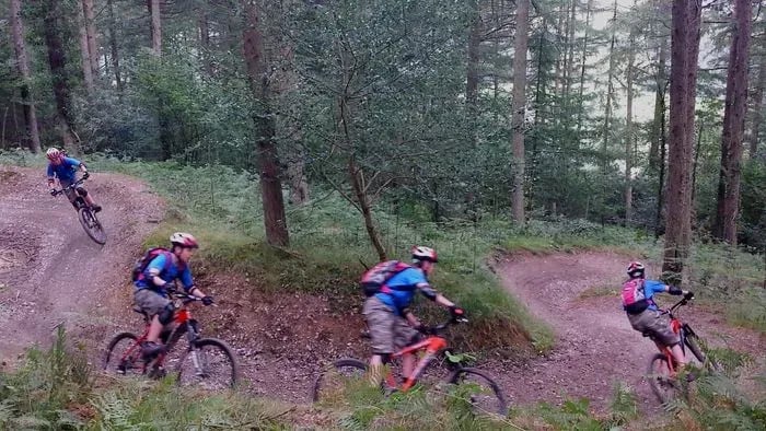
Description
Cwm Rhaeadr Mountain Bike Trails
Cwm Rhaeadr is normally a 6.7km red-graded trail in Natural Resources Wales forestry above Cilycwm, Carmarthenshire, climbing on fire road before dropping into singletrack with drops, rocky steps, rollers and big berms past the waterfall the wood takes its name from. Storm Darragh (December 2024) closed most of the route: only a temporary loop of around 2km is currently open, and Natural Resources Wales expects full recovery to take several years. Check the latest status before you travel.
The Trail
- The full red route is 6.7km, waymarked from the car park: around 2.7km of fire road to gain height, then around 4km of singletrack down a rocky ridge with drops, rocky steps, rollers and big berms. Confirmed against Natural Resources Wales' own trail listing and Mountain Bike Wales.
- The waterfall (rhaeadr) that gives the forest its name drops off Mynydd Mallaen partway down, with views over the Tywi valley and the Brecon Beacons beyond on a clear day.
- Storm Darragh (December 2024) caused significant damage across Cwm Rhaeadr, Brechfa and Caio forests. Only a temporary loop of around 2km of Cwm Rhaeadr is currently open while the rest of the trail is assessed and repaired, and Natural Resources Wales expects recovery across the wider estate to take three to five years. Always check the Natural Resources Wales page for the current status before setting off.
- There are no facilities on site beyond a small picnic area at the car park, but Cilycwm village and Llandovery both have food and drink close by.
Gravel Riding
Continue past the car park towards Llyn Brianne reservoir and the valley opens up a network of forest and gravel roads around the dam and through Tywi Forest, a worthwhile extension if you've brought a gravel bike or fancy stretching your legs after the red trail.
Local Organisations
Brechfa is around 20 miles away and worth combining with a visit here. Brechfa MTB CIC maintains the trails there under contract to Natural Resources Wales and posts wider Carmarthenshire trail and storm recovery updates worth following if you're planning a trip to either forest.
Getting Here
- Cwm Rhaeadr Car Park, Cilycwm, Carmarthenshire, SA20 0NT. Follow signs for Cilycwm from the A482 or A483 near Llandovery; through the village, continue north towards Llyn Brianne Reservoir for about 2 miles to the car park on the left. The postcode covers a wide area and will not take satnav directly to the gate, so use the directions above alongside it.
- Overnight parking is not permitted.
- There is no public transport to the trailhead. The nearest railway station is Llandovery, around 6 miles away.
Share
- If you have visited Cwm Rhaeadr Mountain Bike Trails, please share your reviews, photos, and videos to this listing.