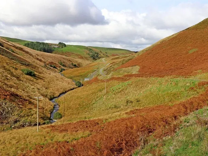
Description
Doethie Valley Mountain Bike Route
Doethie Valley is one of Wales' most celebrated wild mountain bike rides: a roughly 23km natural loop through the Cambrian Mountains above Llyn Brianne, built entirely from open hill, forestry track and unwaymarked singletrack rather than any managed trail network. Its centrepiece is a long, flowing singletrack descent that follows the Afon Doethie back down the valley, mixing baked dirt, loose slate, rock slabs and stream crossings, set against some of the most remote and dramatic scenery in mid Wales. It won MBR magazine's Trail of the Year in 2011 and remains a rite of passage for riders who want a proper wilderness ride rather than a graded trail centre loop.
The Trails
Doethie Valley isn't a signed network of graded trails, it's a single wild loop of around 23km (roughly 14 miles), stitched together from open moorland, forestry track and an unwaymarked singletrack descent along the Afon Doethie. Expect a long, steep climb on loose shale away from Llyn Brianne, several kilometres of undulating, technical descent through the valley (rocks, roots, loose slate and stream crossings) and a mix of double-track and open hill to close the loop. Around two thirds of the distance is fire road or estate track linking the singletrack sections, and there are field gates to open and close along the way, so this rides much more like a proper wilderness adventure than a trail centre visit. It's at its best in a dry spell: the valley floor turns boggy and the climbs get considerably harder after sustained wet weather, so treat a summer visit as the reward and a winter one as a tougher, slower proposition.
Getting Here
Park at Llyn Brianne Dam car park (SA20 0PG), reached via the mountain road that climbs north from Rhandirmwyn, itself signed off the A483/A40 near Llandovery. The car park sits at the southern end of the reservoir and is the recognised starting point for the loop. There's no public transport within reach of the reservoir, so a car is effectively essential. This is remote, satnav-unfriendly terrain with long sections away from any road, so download a route or use GPS navigation before you set off, and let someone know your plan given how little passing traffic there is out here.
Share
- If you have visited Doethie Valley, please share your reviews, photos, and videos to this listing.