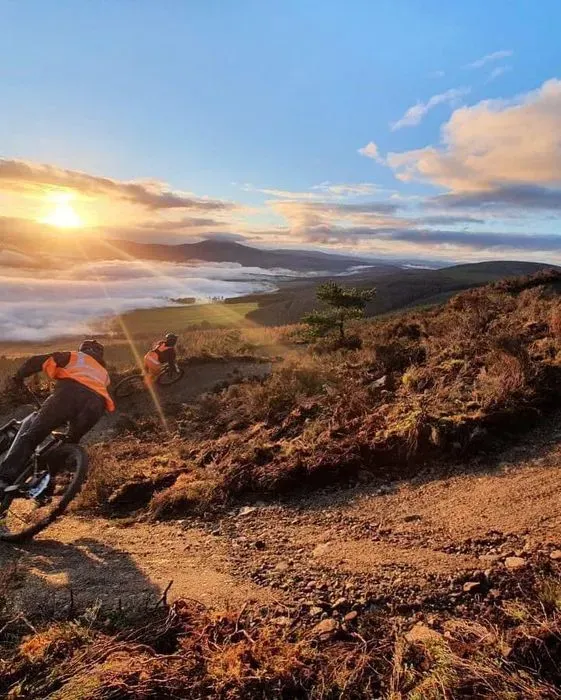
Description
Tarland Trails Pittenderich in Aberdeenshire is the larger of the two Tarland Trails bases, with around 17km of blue, red and black trails across 12 sections. The smaller, beginner-friendly site at Drummy Woods is about a mile away. Pittenderich is for intermediate and advanced riders. Both sites are suitable for Adaptive Mountain Bikes, with the exception of the red trail at Drummy Woods.
Tarland Trails - Pittenderich
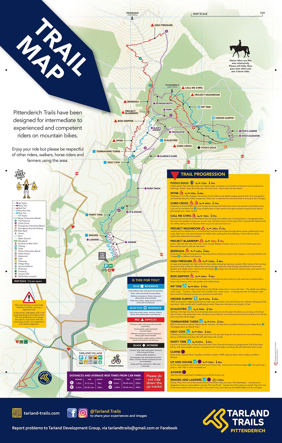
- There are 12 sections of trails consisting of sweeping turns, big berms, jumps, and technical riding. There is a large car park on-site and approximately 17km of trails in total. It is possible to mix and match different sections. Access the detailed trail map to see how.
Red Trails
- The first red has four sections and kicks off with High Pressure. This is open and exposed, high up on the hill. This section is 1,550m long and has 80m of vertical descent. After taking in the panoramic views of Morven, Mount Keen, and Lochnagar, drop into a fast-flowing track with berms, short rock gardens, and rollable drops. Watch out for Rim Dinger, the rock drop on High Pressure, which can damage your rims if your tyres are underinflated.
This then leads into Bermuda (660m long with 40m of vertical descent). Steep twisting berms before exiting the woods to Bon Gripper (or you can change tack through the Bermuda Triangle for different trail options). There is also a red tech trail called Project Blaeberry: a fast, rake-and-ride trail with roots and rocks through blaeberry bushes.
Bon Gripper (540m long and 50m of vertical descent) exits the tree line with flowy berms, short rock gardens, and rollable drops before heading into the last section, Spine.
Spine (540m long with 40m of vertical descent) is steep, with rock gardens and technical descents. After the last section, you can take the fire road back to the top or merge onto the blue trail. - The second main red is made up of two sections: Call Me Chris (760m long with 95m of vertical descent), full of berms with a few short rock gardens, leading into Chris Cross (805m long with 70m of vertical descent), which is flowier, with berms, short rock gardens, and rollable drops. A standout feature is the Whale Tail, a log roll with a kicker.
- The third red is Project Mushroom (555m, 75m descent), a hand-finished technical trail winding through dense woods, packed with roots, rocks, tight turns, and natural features. It leads on to either the black Fools Gold or the blue Crowd Surfin.
Blue Trails
The main blue trail is made up of 5 sections:
- Scalextric (860m long with 75m of vertical descent): starts in the high tree line and swoops down onto the open hill then twists and turns into the next section.
- Tomnaverie Turns (215m long with 25m of vertical descent): flanker stones entrance with fast turns ending at Mega Berm.
- Holy Cow (980m long with 45m of vertical descent): into the tree line for fast-flowing berms, some steep sections with optional kickers and drop-offs. You can also enter this section from the end of the first red described above.
- Party Time (555m long and 55m of vertical descent): fast flowy berms, some steeper sections, a few kickers, and optional drop-offs.
- Snakes and Ladders (830m long): meet The Gatekeeper, a double berm designed to slow you down before crossing The Cow Portal (caution: gates may be closed). Then down the mellow trail to the car park, or go back up and do it again.
The second blue is made up of two sections:
- Rip Tide (857m, 77m descent): a Blue+ flow-tech trail, Call Me Chris's easier cousin, added in August 2024. Starts from the summit of Pittenderich and descends the eastern slopes with rock features, tight berms and occasional jumps.
- Crowd Surfin (815m with 50m of vertical descent): a blue jump trail with berms, tabletops, and kickers continuing from Rip Tide.
Black Trails
- Fools Gold: 725m long with 70m of vertical descent. Steep with non-optional large berms, tabletops, drop-offs and jumps.
- Mike's Elevator is an eBike (or hardy analogue riders) climb in the jump zone, allowing riders to quickly return to the top of the trails with a bit of technicality thrown in.
Trail Map
View Pittenderich trail map
Getting Here
- Car Park, Smallburn, Tarland, AB34 4TB. Pittenderich is also cycling distance from Tarland village.
- A defibrillator and bike wash are available in the car park.
Share
- If you have ridden Tarland Trails Pittenderich, please share your reviews, photos and videos to this listing.
A snapshot of what riders say about this trail
Riders describe Tarland Trails Pittenderich as one of Scotland's best-loved trail centres, built across forest and open moorland with a mix of flowing and more technical lines spanning the Tarland Trails 1 and 2 network. Regular volunteer trail days keep even the technical rock gardens smooth, and reviewers credit the person leading the build, Chris, for the community spirit around the venue, alongside practical extras like a car park, toilets and a newly added bike wash station.
One rider summed it up plainly: "we've ridden many trail centres across Scotland, but Tarland Trails is still our favourite."