Description
Innerleithen and the Golfie
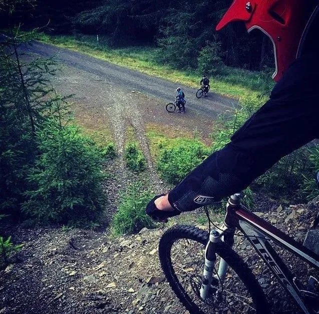
Innerleithen and the Golfie mountain bike trails sit in the Tweed Valley just outside Peebles on the Scottish Borders, two predominantly downhill bases within a short pedal of each other. Innerleithen itself is an FLS-managed 7stanes centre with four graded downhill runs and a red-graded XC route out to Traquair. Across the valley, the Golfie (Caberston Forest) is a much bigger web of natural, rider-built trails, with around 60 lines cut into the hillside across every grade. Adrenalin Uplift shuttles riders to the top of the Innerleithen downhill runs. The Golfie has no uplift.
The Trails
Innerleithen
- Make or Brake: 0.9 miles / 1.45km, Orange-graded downhill
- Matador: 1.2 miles / 1.9km, Orange-graded downhill, the best known of the four
- Gold Run: 0.9 miles / 1.4km, Orange-graded downhill
- Cresta Run: 0.9 miles / 1.5km, Orange-graded downhill
- Traquair XC: a 19km red-graded route with black options, climbing to the summit of Minch Moor via the Stell Burn Climb, the Mousetrap and Lead Mine Climb, before descending through Plora Craig and Caddon Bank
Expect rock steps, big drops, rock chutes, doubles and gap jumps on the downhill runs. A full-face helmet, body armour and a downhill-specific bike are strongly recommended. Signed push-up paths climb over 300 vertical metres to the top, around 45 to 60 minutes, so most riders use Adrenalin Uplift's shuttle instead.
A large, machine-built line known as the Mega Track appeared on the hillside in December 2025. It was built without permission from Forestry and Land Scotland, which confirmed in February 2026 that the unauthorised build is under formal review, with outcomes ranging from formal adoption to restriction or removal still undecided. The line remains rideable while that review continues, but its long-term future here is not settled, so expect the situation to change.
The Golfie (Caberston Forest)
The Golfie is a much larger network of natural, rider-built trails on the hillside opposite, historically unofficial but increasingly brought under formal management by the Tweed Valley Trails Association working with Forestry and Land Scotland. Around 60 trails are rated on a 1 to 5 difficulty scale, roughly 2 pro, 49 black, 3 red, 2 blue and 4 green lines, including well-known runs like Flat White, Final Fling, 3G, Repeat Offender, Community Service, NY NY, Waterworld and Nae Spleens, which reopened in 2026 after a rebuild with stone pitching and rock armouring. Much of the network remains informal and unsigned, so download a route or use GPS navigation before you set off, and consider buddying up with someone who knows the trails.
Innerleithen's downhill scene predates the XC investment that brought it into the 7stanes network by over a decade, and it sits just down the road from its sister trail centre at Glentress. The venue placed 2nd in Scotland's Trail of the Year in 2014 and 3rd in 2016.
Local Organisations
The Tweed Valley Trails Association is a registered Scottish charity maintaining and developing the trail network across the whole of the Tweed Valley Forest Park, including the ongoing work to bring more of the Golfie's trails under formal management. Find them on Facebook or Instagram. TVTA is also working with Developing Mountain Biking in Scotland to make Innerleithen a more accessible destination for adaptive mountain bikers.
Getting Here
Innerleithen: from the A72, turn onto the B709 for Traquair. Innerleithen Trails Car Park (Traquair Road, EH44 6PW) is on the left, about 50 metres over the bridge. Parking is £1.50 for up to an hour or £4 for the day; Blue Badge holders park free.
The Golfie: park at the Red Bull car park or at the smaller car park on the B709 Leithen Road. There is no uplift on the Golfie. Please don't park on residential streets, and note the small parking area at the forest gate belongs to the local golf club.
Trails at Innerleithen and the Golfie are subject to periodic closures and diversions due to forestry operations. Always check the FLS destination page for current alerts before travelling.
Prices were correct at the time of writing but are subject to change, so check current rates before you visit.
Share
- If you have ridden the mountain bike trails or downhill runs here at Innerleithen or the Golfie then why not share your experiences and write a review below and or post some photos or vids to the listing.