Description
Wetherby's mountain biking is spread across three linked community-built sites: the signposted, roughly 20 mile (32 km) Red Kite Trail on local bridleways, the beginner-friendly Little Toe pump track, and the Devil's Toenail Bike Park, with graded blue and red trails, berms, jumps and drop-offs. They sit between Wetherby, Leeds and Harrogate, linked by the traffic-free Harland Way.
The Trails
- Red Kite Trail: a signposted, roughly 20 mile (32 km) loop of existing bridleways out of Wetherby, taking in Spofforth, Sicklinghall, Wood Hall, East Keswick, Bardsey, Hetchell and Bramham. Mostly beginner-friendly, with some stony, rooty singletrack and the odd sharp climb, and parts can get muddy in wet weather. Two longer variants, The Buzzard (35 km) and Little Buzzard (28 km), extend the route further for riders wanting more distance. Here's a route map.
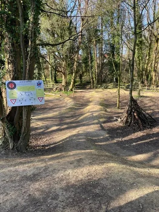
- Little Toe Pump Track: a small, footprint-shaped pump track on Millennium Field, built by local volunteers for younger and less experienced riders.
- Devil's Toenail Bike Park: around a kilometre of purpose-built trails graded blue and red, with berms, jumps and drop-offs, built on former railway land off the Harland Way.
Gravel Riding
The Harland Way, the old Wetherby to Spofforth railway line, gives a traffic-free, stone-surfaced link between the trailheads and doubles as a family-friendly ride or walk in its own right, continuing on to Spofforth Castle. It suits gravel and hybrid bikes rather than road tyres, and North Yorkshire Council has been resurfacing sections, so expect some variation in surface quality along the way.
Nearby: Wetherby BMX Track
- Wetherby also has its own Wetherby BMX Track, a separate volunteer-rebuilt site off Sustrans Route 67 near Freemans Way. See its own listing for details and directions.
Getting Here
- Parking for the Red Kite Trail, Little Toe and Devil's Toenail is at Station Gardens (the old station car park), Linton Road, Wetherby, LS22 6YR. Head up the Harland Way cycle path and follow the signs. Please do not park on Quarry Hill Lane.
- Wetherby's own railway station closed in 1964, so there's no direct rail link. Regular bus services connect the town to Leeds and Harrogate.
Local Organisations
- The trails are maintained by volunteer group Wetherby Bike Trails, working with trail-building charity SingletrAction and Wetherby Town Council. Connect with the local community for the latest info and dig days on their Facebook Group.
Share
- If you have ridden any of the Wetherby trails then please leave a review and post your pictures, tracks and GPS videos to this listing.