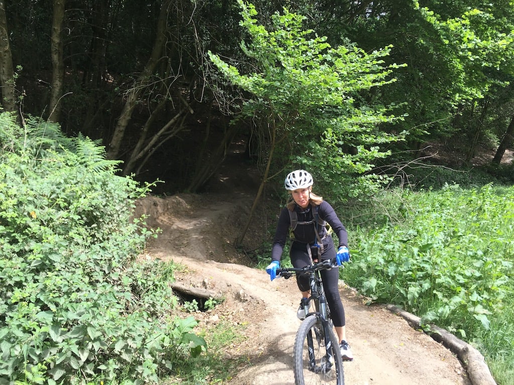
Description
Surrey Hills Mountain Biking
Surrey Hills mountain biking crisscrosses the North Downs across three hills: Leith Hill, Holmbury Hill and Pitch Hill. Between them there are around a dozen key named trails, plus a much larger and ever-changing web of natural, unofficial lines, and a network of fire roads and bridleways for gravel riding between the hills. The one official waymarked trail, Summer Lightning on Leith Hill, is red graded, so download a route or use GPS navigation before you set off.
Each hill can be ridden on its own or linked into a longer loop. Holmbury Hill and Pitch Hill mix purpose-built singletrack with a much larger, ever-changing web of informal lines under the Hurtwood's right to roam, while Leith Hill's riding is more contained around its one official trail. Rock up at one of the car parks below, or check the resources section for route guides.
Leith Hill
- Leith Hill is the steepest of the three and home to The Tower, the highest point on Leith Hill and the highest point in the North Downs. Expect tough climbs and rewarding descents. The Tanhouse kiosk at the top of the Tower serves tea, cake and hot snacks on weekends and school holidays. Nirvana Cycles in Westcott, at the foot of the hill, is a popular starting point with maps and informal shop rides.
- Summer Lightning is the area's only official waymarked trail, a 7.3km red-graded loop starting and finishing near the Tower. Check surreyhills.org for current conditions before you ride, since the trail is periodically closed for repair or maintenance work.
- Park at Landslip Car Park, south of Coldharbour village on Abinger Road, and pick up the footpath at the top end of the car park, which climbs to Leith Hill Tower where the trail starts.
- Leith Hill is a mix of National Trust, Forestry Commission and private land, and much of the hill is a Site of Special Scientific Interest for its breeding woodland birds, including all three British woodpecker species. Some riders explore beyond Summer Lightning, but keep to rights of way open to cyclists and to dedicated MTB trails, and stay off footpaths and unmarked routes.
Holmbury Hill
- Rides start from Peaslake village, home to Peaslake Village Stores, a village shop turned local institution for tea, coffee and cake, popular with riders and walkers.
- Trails include Barry Knows Best (the hill's most famous trail, starting at the top of Radnor Road opposite the reservoir, with a sterner red-graded sister line in Barry Knows Better), Yoghurt Pots (rolling bomb-holes through the woods, also known as Park Life) and Telegraph Row (tight, flowing singletrack finishing near the Youth Hostel car park), with technical black lines on Crackpipe and Wet n Wild, plus a wider web of green and blue singletrack, including Delirium, Secret Garden, Secret Squirrel, Jackie Brown and Mutiny, radiating out from Holmbury St Mary.
- Holmbury Hill is part of the Hurtwood, where a 1926 Deed of Dedication by landowner Reggie Bray gave the public a formal right to roam "for air and exercise". In practice that means you can ride any trail or footpath here unless a sign specifically says no bikes, though building new trails without permission from Friends of the Hurtwood is against the rules, and unauthorised digging does get closed. Follow the Hurtwood Biker's Code.
Pitch Hill
- Pitch Hill has the same abundance of singletrack as its neighbours, with trails including Supernova, Curly Wurly, Vauxhall Nova and Rad Lane (also known as Proper Bo). A waymarked "T" system also runs off the hill: T0 into John the Baptist (marked T2 to T4) into the T Trails (T1), one of the longest continuous singletrack routes in the area, running from near the summit back down to Walking Bottom car park. Elsewhere on the hill there's fast blue flow on El Capitan, Roller Coaster, Mike TV and Area 51, plus further unofficial trails, including some black-graded lines, on the hill's steeper southern and western slopes. Expect rooty, flowing riding with berms and small jumps.
- Peaslake is also a good starting point for Pitch Hill. It's part of the Hurtwood, so the same "right to roam" access and Hurtwood Biker's Code apply.
Gravel Riding
- Away from the singletrack, the Hurtwood and the wider Surrey Hills carry a network of fire roads, bridleways and byways connecting Peaslake, Holmbury Hill, Pitch Hill and Leith Hill. These are popular with gravel and road riders as well as mountain bikers, with routes heading out from Peaslake onto wide compacted climbs and descents. The area is also used for organised gravel events. Little of this network is waymarked, so download a route or use GPS navigation before you set off.
Local Organisations
- Hurtwood Trails is the volunteer group behind trail building and maintenance on the Hurtwood Estate.
- Friends of the Hurtwood is the charity that manages access across the whole Hurtwood on behalf of its landowners and publishes the Hurtwood Biker's Code.
- London Calling MTB and Surrey Hills MTB are active local riding groups.
- girls ALIVE is a women’s community sports charity in Surrey. Its mountain bike rides use the trails around Leith Hill, Holmbury Hill, Pitch Hill and Ranmore, at beginner, intermediate and technical levels, with two ride leaders on each ride so a range of paces can ride together. Membership is paid, with a free trial month for newcomers.
- Just Pedal runs guided ride outs from the Hurtwood Hideout, including a women’s ride about once a month, with demo Specialized mountain bikes and e-bikes available to hire.
Resources and Routes
- Surrey Hills Mountain Biking is the area's own site, with dedicated pages and directions for each hill and trail.
- MBR has a free GPS route around Peaslake and the Surrey Hills, taking in Barry Knows Best, Yoghurt Pots and Summer Lightning.
Getting Here
- Primary car park: Hurtwood Car Park 2 (Walking Bottom), postcode GU5 9QW. Peaslake sits on the B2128 between Shere/Gomshall and Ewhurst/Cranleigh, a few miles south of the A25 Guildford to Dorking road. Follow the B2128 into the village, then continue past the Hurtwood Inn and Pedal and Spoke; the car park is on the left after around 300m. It's the biggest and most popular car park in the area, so arrive before 9:30am on weekends for a space, or after 11am once early risers head home. Don't park in Peaslake village centre itself.
- Alternative car parks: several smaller Hurtwood car parks are dotted around Holmbury Hill and Pitch Hill if Walking Bottom is full or you want a different starting point. For Leith Hill specifically, park at Landslip Car Park on Abinger Road, south of Coldharbour, and follow the footpath up to the Tower.
- By train: Gomshall station, on the Guildford to Redhill line, is the closest, around 2 to 3 miles from Peaslake. Guildford (Portsmouth/Waterloo mainline, about 35 to 40 minutes from London) and Dorking Deepdene (around an hour from London Victoria) are the nearest mainline stations.
Share
- If you have visited Surrey Hills Mountain Biking, please share your reviews, photos, and videos to this listing.